Drones
Showing all 4 results
-
Drones
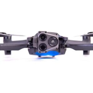
Parrot ANAFI USA GOV Edition Aerial drone bundle with thermal/electro-optical sensors and smart remote controller
 Drones
Parrot ANAFI USA GOV Edition Aerial drone bundle with thermal/electro-optical sensors and smart remote controller
Product highlights:
- quadcopter with 4K camera, thermal/electro-optical sensors, and controller
- designed for first responders and enterprise professionals
- foldable, lightweight design makes it easy to carry to your launch destination
- can be deployed in just under a minute
- low-noise flight technology for a quieter flight
- accurate flight positioning with GPS, GLONASS, and GALILEO
- operating temperature: -32° to 110°F
- resists winds up to 32.8 mph
- IP53-certified against dust and rain
- flight time: up to 32 minutes
- flight range: 3.1 miles (with included Skycontroller USA)
- maximum speed: 32.8 mph
4K visual imaging:
- two 21-megapixel cameras with 1/2.4″ CMOS image and EO (electro-optical) sensors
- Telephoto EO sensor with 32X digital zoom
- Wide EO sensor @ 84° FOV (field of view)
- rectilinear up to 16-megapixel @ 75.5° FOV
- shutter speed: 1 to 1/10,000 second
- ISO range: 100-3200
Thermal imaging:
- FLIR BOSON 320 IR (infrared) sensor
- thermal resolution: 320 x 256 @ 60 Hz
- 50° HFOV (horizontal field of view)
- temperature range: 14°F to 302°F
- thermal video recording: 1280 x 720 @ 9fps
- 2-axis mechanical stabilization and 3-axis digital stabilization via image processing
- gimbal tilt: -140° to +110°
Skycontroller USA smart controller:
- integrated 8″ touchscreen
- built-in FreeFlight 6 app
- displays standard view, thermal view, or blended image
- supports a secure WPA2 Wi-Fi connection to the drone
Flight system:
- fly autonomously or via preset flight plans
- supports POI (points of interest) and waypoints
- RTH (return to home) feature initiates automatically if the drone disconnects or runs low on battery
- drone can fly indoors without GPS, letting it seamlessly transition in and out of a building
- selectable altitude fencing and geofencing provides first responders increased flexibility
- range of sensors provide precise environmental feedback
- barometer, magnetometer, ultra-sonar, vertical camera
- 2 x 6-axis IMU (inertial measurement unit)
- 2 x 3-axis accelerometers and gyroscopes
Software and security features:
- supports open-source SDK and industry-standard protocols
- works with Survae, DroneLogbook, Kittyhawk, DroneSense, PlanckAerosystems, and Skyward
- flight data and logs aren’t saved or uploaded by default
- users can opt in using the FreeFlight 6 app to anonymously store data to Parrot’s secure servers in Europe
- compliant with the European Union General Data Protection Regulation (GDPR)
- users can replay, edit, and analyze thermal footage without downloading it
- footage can be stored locally on the drone or exported to an SD card
- data stored to an SD card is encrypted and cannot be read without a decryption key
- encryption uses an AES-XTS encryption algorithm with a 512-bit key length
SKU: 5487FB8/19 -
Drones
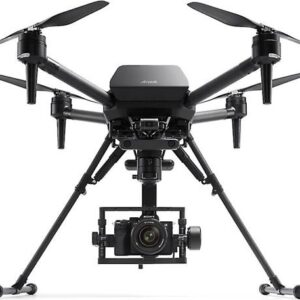
Sony Airpeak S1 Aerial quadcopter and remote controller
Product highlights:
- quadcopter with FPV camera, remote controller, two batteries, and charger
- can carry a gimbal + camera system up to 5.5 lbs.
- compatible with select Sony Alpha full-frame mirrorless cameras and select E-mount lenses
- cameras: ILCE-1, ILME-FX3, ILCE-7C, ILCE-9M2, ILCE-7SM3, ILCE-7RM4, ILCE-7RM3, ILCE-7M3, and ILCE-9
- lenses: SEL14F18GM, SEL20F18G, SEL24F14GM, SEL24F28G, SEL28F20, SEL35F28Z, SEL35F18F, SEL40F25G, SEL50F25G, SEL50F18F, SEL50M28, SEL55F18Z, and SEL85F18
- mount camera with Gremsy Gimbal T3 (sold separately)
- flies up to 55.9 mph
- resists winds up to 44.7 mph
- flight time: 22 minutes (without payload); 12 minutes (full payload)
- retractable landing gear keeps your camera’s field of view unobstructed
- detachable 17-inch propellers with quick-release for easy transport and replacement
- hot-swappable battery lets you exchange your power supply without turning off the aircraft
Safety features:
- five-way stereo cameras with high-speed vision-sensing processing for real-time 3D spatial awareness and obstacle detection
- processor integrates with IMU (Inertial Measurement Unit), compass, barometric pressure, and infrared range sensors
- stable flight in enclosed areas or outside of the range of GNSS (Global Navigation Satellite System)
- automatic deceleration and braking let the aircraft safely navigate complex environments
- automatic Return to Home (RTH) when the battery is low or the drone loses signal
- can automatically generate routes that bypass restricted airspace during RTH
- aircraft performs a full systems check before flight and can perform self-checks mid-flight
- warns pilot in the case of a problem and either prevents takeoff or performs an emergency landing as required
Flight system:
- incudes remote controller with customizable button configuration
- mounts smartphones and tablets with up to 7″ screens
- can be fitted with an optional harness for long shoots (sold separately)
- HDMI port lets you connect an external screen to the controller
- Airpeak Flight mobile app lets you control, monitor, and manage the drone as well as the connected gimbal and camera
- make setting adjustments mid-flight with connected Sony Alpha full-frame mirrorless cameras
- Airpeak Base web app helps you organize projects and manage your equipment from a secure account
- plan a flight route with detailed control over speed, positioning, and camera movements
- download flight logs to review previous missions and use that data to plan future routes
- supports straight and curved flight paths
- diverse range of manual and automatic flight modes:
- Standard Mode is turned on by default and utilizes all sensors for safe, stable flight
- Velocity Mode improves hovering and maneuvering for accurate flight path recreation
- Mission Flight lets you execute preset flight paths and Repeat Flight retraces the path of a previous mission
- Dual Operation Mode lets you and a partner control the drone and gimbal/camera independently
- pilot controls the drone via a FPV camera on the nose of the aircraft
- camera operator controls the camera and gimbal to capture footage
- requires two remote controllers (extra controller sold separately)
General info and included accessories:
- one micro-USB cable and two USB-C cables
- two flight batteries and charger
- 23-3/8″W x 36-13/16″H x 20-1/4″D (landing gear down); 39-7/8″W x 20-3/4″H x 20-1/4″D (landing gear up)
- weight: 6.93 lbs. (without battery)
- warranty: 1 year
SKU: 5487FB8/43 - quadcopter with FPV camera, remote controller, two batteries, and charger
-
Drones
DJI Matrice 350 RTK Worry-free Basic Combo Commercial-grade quadcopter with two flight batteries, battery station, smart controller, carrying case, and Enterprise Care Basic protection plan
 Drones
DJI Matrice 350 RTK Worry-free Basic Combo Commercial-grade quadcopter with two flight batteries, battery station, smart controller, carrying case, and Enterprise Care Basic protection plan
Product highlights:
- flagship enterprise quadcopter designed for inspection, surveying and mapping, and other commercial applications
- redesigned hot-swappable dual battery system takes two TB65 Intelligent Flight Batteries (pair included) at a time
- includes next-gen BS65 Intelligent Battery Station for easier battery charging, storage, and transport
- includes remote controller and rugged carrying case for drone and accessories
- built-in RTK (real-time kinematics) provides exceptional positioning and surveying accuracy
- GPS/Galileo/BeiDou positioning
- Enterprise Care Basic product replacement plan included
- Enterprise Care Basic must be activated within 48 hours of registering your drone
- flies up to 51.4 mph
- resists winds up to 26.8 mph
- flight time: up to 55 minutes
- maximum altitude: 4.35 miles (7,000 meters) with optional 2112 propellers
- IP55-rated dust- and water-resistant
Support for multiple payloads:
- carries up to three payloads simultaneously
- no payloads included
- supports single downward gimbal, dual downward gimbals, and single upward gimbal (gimbal connector sold separately)
- maximum payload capacity: 5.95 lbs.
- E-port open interface
- works with powerful H20 system payloads for inspection and aerial imaging (sold separately)
- Zenmuse H20 hybrid camera with laser rangefinder
- Zenmuse H20Nhybrid visual/thermal camera system
- Zenmuse H20T hybrid camera with radiometric thermal sensor and laser rangefinder
- works with P1 and L1 payloads for surveying and mapping (sold separately)
- Zenmuse P1 camera for aerial photogrammetry
- Zenmuse L1 hybrid 4K camera and lidar sensor
Enhanced safety features:
- built-in night vision FPV camera
- six-directional obstacle avoidance
- arm lock indicator to avoid the risk of unlocked arm sleeves
- multi-layered redundancy design for aircraft and sensor system for maximum flight safety
- compatible with CSM radar module (sold separately) for subtle obstacle avoidance in a 360° horizontal pattern
RC Plus remote controller:
- 7-inch high-brightness touchscreen
- brightness: 1,200 nits
- ergonomic design with customizable buttons
- can connect with a second controller (sold separately) for dual-control mode
- dual independent connections allow pilot and camera operator to be in different positions on set
- if the pilot loses connection, the camera operator automatically gains control of the drone as a failsafe
- OcuSync 3 Enterprise digital video transmission system:
- supports triple-channel 1080p live video feeds from drone up to 12.4 miles away
- aircraft and controller each have a four-antenna transceiver system for transmission stability
- built-in DJI Pilot 2 flight app provides efficient, intuitive flight control
- optimized to clearly present mission and flight status
- smooth control of aircraft and payloads
- built-in Wi-Fi 6 and Bluetooth®
- operating temperature: -4° to 122°F
- battery life: 6 hours (built-in and external batteries), 3.3 hours (built-in batteries only)
- external WB37 battery is hot-swappable
Intelligent operation features:
- high-precision mapping
- supports Waypoint, Mapping, Oblique, and Linear Flight missions
- works with DJI Terra software for high-precision, high-efficiency 2D and 3D mapping
- air-to-ground coordination
- supports high-precision PinPoint function and cloud-based real-time mapping
- DJI FlightHub 2 software quickly models the mission site and transmits command information to aircraft and ground operators
- automated precision inspection
- Live Mission recording generates and stores flight route files for automated inspections or other repetitive missions
- AI Spot-Check allows automated subject framing with manual adjustments for more accurate shooting
SKU: 5487FB8/33 -
Drones
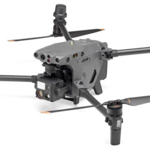
DJI Matrice 30T with Enterprise Care Plus Aerial drone with gimbal-mounted thermal and 4K wide/zoom cameras, rangefinder, and protection plan
 Drones
DJI Matrice 30T with Enterprise Care Plus Aerial drone with gimbal-mounted thermal and 4K wide/zoom cameras, rangefinder, and protection plan
Product highlights:
- quadcopter with dual 4K wide/zoom cameras, laser rangefinder, controller, battery, and charger
- foldable, lightweight design makes it easy to carry to your launch destination
- DJI Care Enterprise Plus product replacement plan included
- must be activated within 48 hours of registering your drone
- auxiliary safety lights help you track the drone in the air
- built-in RTK module provides incredibly precise real-time positioning data for mapping, surveying, and inspections
- hyper-accurate flight positioning with GPS, GALILEO, and BeiDou
- GLONASS supported when RTK module is enabled
- compatible with the portable DJI Dock for quick charging, storage, and mission planning (sold separately)
- operating temperature: -4° to 122°F
- IP55-certified against dust and rain
- resists winds up to 33.4 mph
- flight time: up to 41 minutes
- maximum speed: 51.3 mph
Imaging:
- thermal camera with Uncooled VOx Microbolometer imager
- thermal resolution: 640×512
- DFOV (display field of view): 61°
- focal length: 40mm (35mm equivalent)
- aperture: f/1.0
- thermal accuracy: ±3.6°F or ±2% (use larger value)
- 12-megapixel wide camera with 1/2″ CMOS sensor
- records 4K video at 30 fps
- focal length: 24mm (35mm equivalent)
- aperture: f/2.8
- DFOV (display field of view): 84°
- 48-megapixel zoom camera with 1/2″ CMOS sensor
- 200X maximum hybrid zoom; 5X to 16X optical zoom
- aperture: f/2.8 to f/4.2
- captures still images in 8K resolution
- records 4K video at 30 fps
- FPV camera with live HD video feed at 30 fps
- DFOV (display field of view): 161°
- optimized for low-light conditions
- laser rangefinder lets you select a target and receive precise coordinates
- range: 9.8 to 3937 feet
- controllable gimbal tilt range:
- ±90° (pan)
- -120° to +45° (tilt)
Flight system:
- DJI Pilot 2 flight app provides efficient, intuitive flight controls
- navigation display tracks flight metrics, nearby obstacles, the flight’s home point, and customizable PinPoints
- comprehensive automatic pre-takeoff checklist so you can fly with confidence
- customize alert notifications to keep track of preset conditions
- six-way dual-vision and ToF (Time of Flight) sensors for robust obstacle detection
- built-in ADS-B receiver (Automatic Dependent Surveillance – Broadcast) tracks active weather and air traffic conditions
- DJI FlightHub 2 for efficient project and mission management across multiple device types (subscription required, 3 months included)
- live mission streaming with multiple teams including live annotations for efficient coordination
- supports 2.5D Base Map and Cloud Mapping
- One-Tap Panorama Sync lets you quickly overview your mission area
- can be synchronized with DJI Pilot 2 for mission planning and automatic file uploads
DJI RC Plus remote controller:
- 7-inch HD touchscreen with built-in DJI Pilot 2 interface
- resolution: 1920 x 1200
- ergonomic design with customizable buttons
- can connect with a second controller (sold separately) for dual-control mode
- OcuSync 3 Enterprise digital video transmission system:
- sends live 1080p video to the controller from up to 9.3 miles away
- dual-band Wi-Fi® 6 with auto-switching
- two pairs of removable dual-antennas (four antennas total)
- built-in Bluetooth® 5.1
- operating temperature: -4° to 122°F
- IP54-certified against dust and rain
- battery life: 6 hours (internal + external battery)
- charge time: 2 hours
Software and security features:
- supports Mobile SDK 5 an open-source software development kit for the Matrice 30 Series
- PSDK merges Payload SDK and Onboard SDK to make it easier to develop and deploy third-party payloads
- connect to third-party cloud platforms without having to develop a new app with Cloud API
- access the drone’s hardware, live video feed, and stored photos
- supports DJI Docks for mission planning, data transfer, and third-party dock management
- AES-256 video transmission encryption
- footage can be stored locally on the drone or exported to an SD card with AES encryption (password protected)
- optional cloud data storage uses Amazon Web Serviced (AWS) and is AES-256-CBC protected
- users can delete all data stored on the drone with a single tap
SKU: 5487FB8/24


